
In collaboration with marine consultancy O2 Marine, Advanced Navigation has revealed an explicit visual depiction of Hall Bank – a small, nearshore reef off Fremantle in south-west Australia (32°S), located well beyond the typical latitudinal range for coral reefs.
Using Hydrus, a micro hovering autonomous underwater vehicle, the teams conducted a detailed survey of the reef, capturing geo-referenced high-resolution imagery and 4K video in parallel. The data showed severe coral bleaching and fragmentation, laying bare a hidden yet escalating crisis at one of the world’s southernmost reefs.
O2 Marine’s ambition lies in aiding businesses to accelerate efforts in marine environmental assessment and monitoring, marine fauna, and oceanography. This necessitates the use of advanced technology to collect data and insights for knowledge-sharing in a cost-effective way.
“To truly understand the extent of coral bleaching, we need high-resolution, spatially accurate data that captures both the scale and the fine detail of change beneath the surface,” said O2 Marine Co-Managing Director Claudio Del Deo.
The data gathered from Hydrus was used to generate a 3D digital twin of the Hall Bank seabed. The model revealed a barren seafloor filled with pale, lifeless corals, documenting the shrinking coral formations.
This comes at a time when both of Australia’s two world heritage-listed reefs, Ningaloo and the Great Barrier Reef, were simultaneously hit by coral bleaching in March 2025, driven by an intense marine heatwave that drove sea surface temperatures up to 4°C above the summer average.
“Unlike traditional underwater vehicles, Hydrus’s compact design, fleet deployability, and ability to gather professional-grade data allow us to monitor reefs at a scale and frequency previously unattainable,” added Del Deo. “This level of detail is essential for informing conservation strategies and building the baseline needed for long-term reef recovery. As we expand our conservation efforts globally, Hydrus is proving to be an indispensable part of our toolkit, enabling actionable insights that will guide both immediate responses and future restoration.”
The Hall Bank site, regarded as a rare and valuable example of high-latitude reef resilience, was an ideal deployment area for Hydrus. Its ability to support extensive coral cover in cold, turbid waters makes it a vital natural lab for studying climate adaptation. Hosting a unique mix of tropical, subtropical, and temperate coral species, it offers critical insights into species range shifts and reef development under changing ocean conditions.
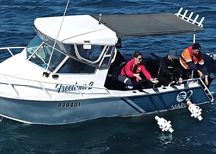
The mission involved the simultaneous deployment of three Hydrus units, each executing coordinated transects and lawnmower survey patterns across different sections of the reef.
This approach enabled comprehensive spatial coverage, ensuring overlapping, high-resolution data capture across the site. By flying precise, parallel tracks, Hydrus was able to systematically map the reef’s structure and condition, capturing the fine-scale changes in coral health that are often missed by traditional survey methods.
“Collecting high-quality ocean data has traditionally been slow, costly, and resource-intensive, where sending divers or ROVs below 50 metres in depth can run into tens or even hundreds and thousands of dollars,” said Advanced Navigation Senior AI Engineer Alec McGregor. “That simply doesn’t scale, especially when time-sensitive data is needed across large or remote areas.”
“Hydrus changes the equation. At just seven kilograms, it can be deployed by a single person without the need for support vessels or complex logistics,” he continued. “This mission is a powerful example of what’s possible when cutting-edge robotics meets urgent environmental challenges. Hydrus puts critical data into the hands of scientists and marine operators faster, more safely, and more affordably, enabling smarter, more timely decisions for conservation and climate adaptation”.
Today, ocean temperatures continue to rise, mass coral bleaching events are becoming more frequent. Yet only 26.1% of the ocean floor has been explored.
To unlock the ocean’s mystery and open it up for further scientific discovery, Advanced Navigation is appealing to the goals of the Seabed 2030 initiative and the overarching United Nations Ocean Decade development plan, by working with partners to map the ocean floor.
This mission builds on Hydrus’s growing track record of underwater discovery and documentation – from coral reefs to shipwrecks.
In 2024, Hydrus spotted a 64-metre shipwreck, more than twice the size of a blue whale, scattered across the seafloor in the Indian Ocean.
Together with Curtin University HIVE, Advanced Navigation was able to rebuild a high-resolution replica of the wreck using the data gathered by Hydrus. The model now sits with the Western Australian Museum’s public archive and can be seen in life-size form at the Curtin University HIVE on their immersive Cylinder display.


