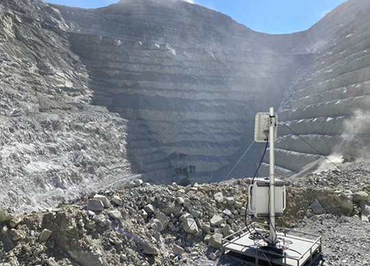
IDS GeoRadar has announced a new software update for RockSpot, IDS GeoRadar’s radar system able to locate, track and notify on rockfalls.
RockSpot’s latest software release expands the data analysis performance with new tools supporting an efficient rockfall risk zonation, TARP fine tuning and back analysis to reduce operational and geotechnical risks.
The new multiple statistical tools allow users to manipulate the events database and plot custom-charts based on defined areas and items – such as event rate, duration/area extension, velocity and run out distance of rockfall – for a comprehensive back analysis, models calibration, integrity of rockfall controls and design change justification.
Rockfalls are a major safety threat in open pit operations. The sudden onset of rockfall events makes it difficult for conventional monitoring methods to provide adequate pre-warning and a comprehensive analysis, resulting in a challenge for mine operators and planners.
RockSpot is the industry’s first end-to-end solution able to trigger notifications on rockfalls in real-time and to maximize rockfall hazard management providing an explorable rockfall database for back analysis and an automatic classification of falling events.
This compact and powerful radar picks up falling rocks in near to real time and working crews receive prompt notification for action along with immediate access to all event’s details, that are tracked, stored and classified in a rockfall events database.
RockSpot provides 24/7 continuous monitoring night and day to actively support in sync risk management with real-time notifications and improves risk mitigation and planning operations with multiple statistical tools to analyse the collected data for cost reductions in mitigation measures.


